January 31, 2022
Research Highlight

Computer-Aided Mapping of Hydromorphic Features in the Columbia River

Columbia River

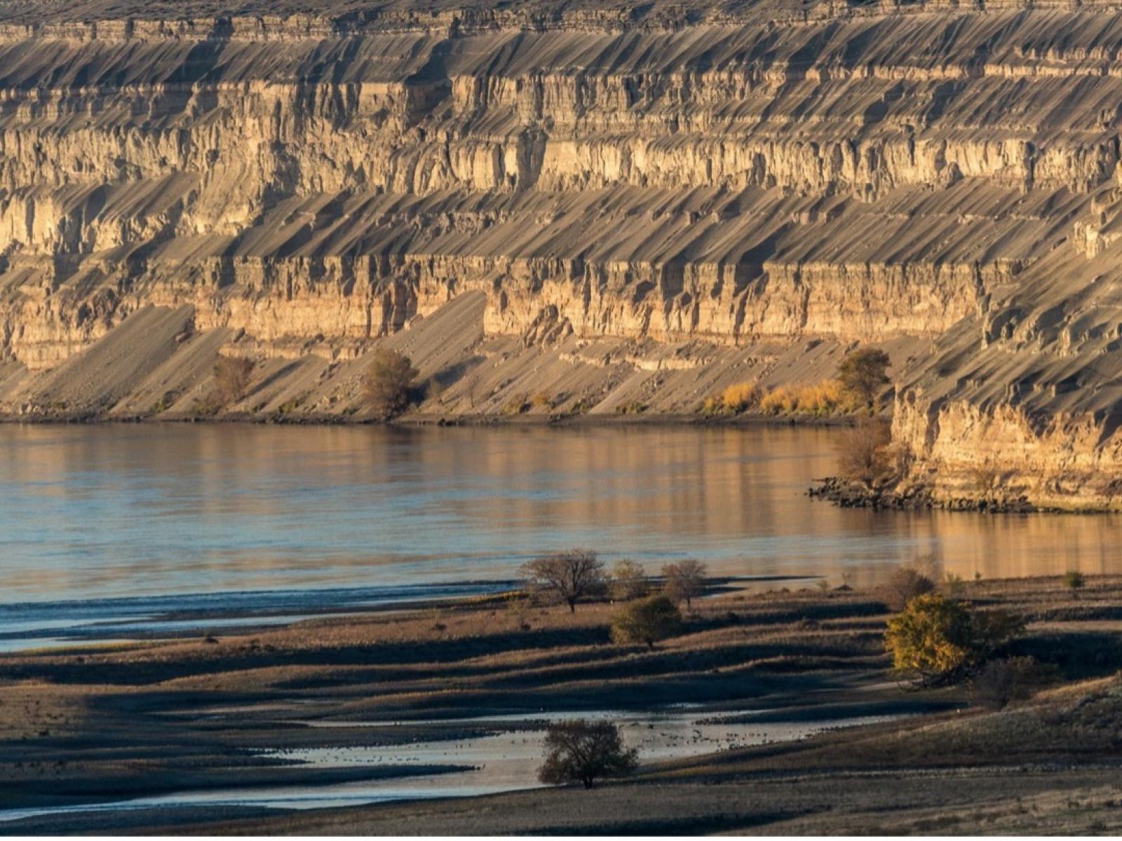
A portion of the Hanford Reach of the Columbia River showing diverse physical features of the river channel. This work provides a systematic and automated method of mapping these features for use in simulations of nutrient cycling and water quality.

(Photo by Andrew Pitman | Pacific Northwest National Laboratory)

The Science                                 

Interactions between flowing water and the geometry of river channels create forces that cause river water to enter the sediments surrounding the channel and eventually return to the channel. Such exchanges of surface and subsurface waters (called hydrologic exchange flows or HEFs) play a critical role in the fate of nutrients and contaminants in the river and thus significantly impact water quality. To simplify and enable computer simulation of these effects in large river reaches, we developed a novel approach to map regions of the riverbed that have similar hydraulic and geometric characteristics (called hydromorphic features) and can be expected to exhibit similar HEFs.

The Impact

Geologists have long mapped hydromorphic features using subjective observations and expert knowledge. Here, we demonstrate a novel application of machine learning to combine hydrologic model outputs with remotely sensed data to perform this work in an objective, consistent, and automated manner. This result is an important step toward improving our ability to predict HEFs and their effects on nutrient cycling and water quality in large, complex river systems.

Summary

The study developed a machine learning method for quantitatively defining and mapping hydromorphic classes and demonstrated the approach on the 70-km Hanford Reach of the Columbia River (southeastern Washington state, USA). The novel approach uses outputs from river flow simulation models (depths and velocities) and remotely sensed bathymetric/topographic data to objectively define and map hydromorphic features. The identified feature classes are shown to correspond to spatially contiguous regions, and these coherent features are physically interpretable and consistent over the entire reach. The accuracy of classifications were verified using field observations of feature geometry and riverbed textural properties. Preliminary analysis of relationships between the mapped hydromorphic features and simulated values of exchange flows and transit time distributions based on high-resolution mechanistic modeling confirm that these important characteristics of river-subsurface exchange are distinct for each feature type, providing a rational basis for using the results of high-resolution mechanistic models (feasible only within limited spatial domains) to predict system behaviors over much larger spatial domains.

Funding

This research was supported by the U.S. Department of Energy, Office of Science, Office of Biological and Environmental Research, Environmental System Science (ESS) program through the River Corridor Scientific Focus Area project at Pacific Northwest National Laboratory.

Published: January 31, 2022

Hou, Z., et al. A novel construct for scaling groundwater–river interactions based on machine-guided hydromorphic classification.” Environmental Research Letters16, 104016 (2021). [DOI: 10.1088/1748-9326/ac24ce]

Research topics