RemPlex provides a global forum committed to fostering technical leadership, collaborative research, and professional development that facilitates the cost-effective remediation of complex sites.
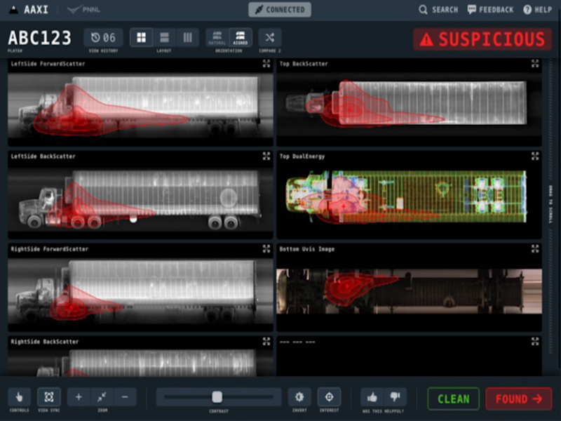
The CVAir pilot project transports computed tomography passenger baggage data from originating international airports for targeted flights destined for the U.S.
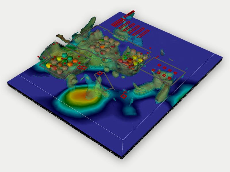
E4D is a 3D geophysical modeling and inversion program designed for subsurface imaging and monitoring using static and time-lapse electrical resistivity tomography (ERT), spectral induced polarization (SIP) and travel-time tomography data.
PNNL’s integrated software systems (FRAMES, MEPAS, MetView, APGEMS, CAPP) allow users to assess the environmental fate and transport of contaminants—and the potential impacts on humans and the environment—in a systematic, holistic approach.
From global issues such as melting permafrost and the creation of alternate biofuels to matters affecting microbiomes and micro-sized life, PNNL research is featured in news publications worldwide.
GeoBOSS is a software library that combines the data-handling capabilities of Spark and the user-friendliness of Python to simplify geospatial analytics and the transition between small-scale research and large-scale operational projects.
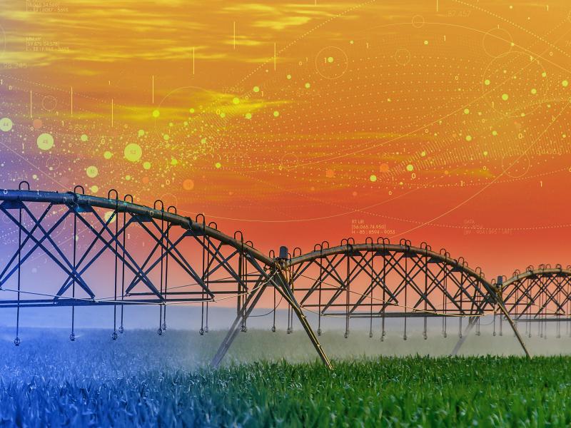
IrrigationViz is a visual decision-support tool that provides users with high-level estimates for irrigation modernization projects, such as concrete lining for a canal or replacing a canal with a pipeline.
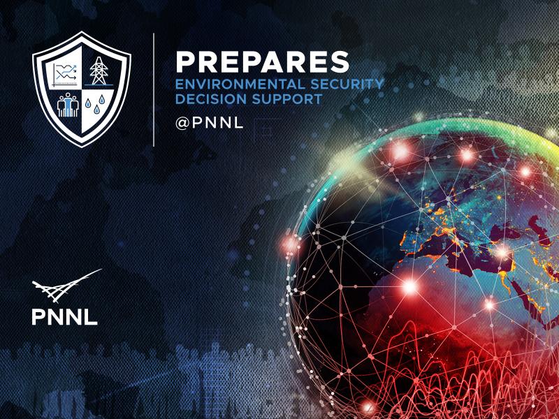
PREPARES demonstrates linkages between climate or weather conditions and human domain systems by combining quantitative geophysical data with qualitative data.
The user-friendly Project Schedule Visualizer software developed at PNNL helps users readily identify and understand the impacts of updates to the schedule, budget, and risks associated with large, complex projects that cross departments.
PNNL combines AI and cloud computing with damage assessment tools to predict the path of wildfires and quickly evaluate the impact of natural disasters, giving first responders an upper hand.
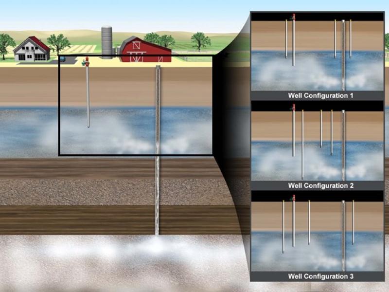
PNNL has developed performance assessment guidance for remediation of volatile contaminants in the vadose zone, inorganic contaminant remediation in the vadose zone, and pump-and-treat of groundwater contaminant plumes.
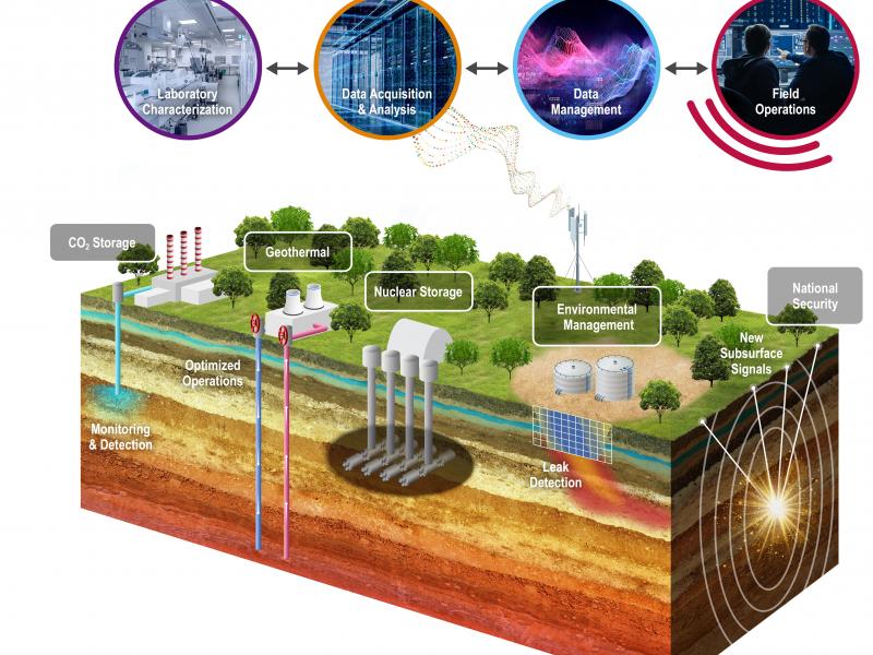
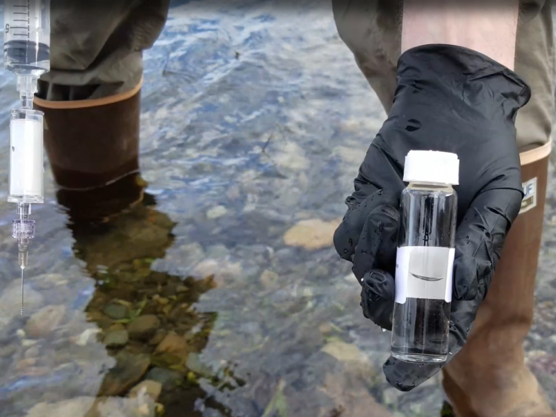
PNNL's River Corridor Hydrobiogeochemistry Scientific Focus Area works to transform understanding of spatial and temporal dynamics in river corridor hydrobiogeochemical functions from molecular reaction to watershed and basin scales.
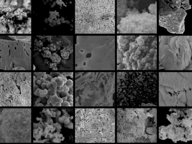
Powered by few-shot learning, the Sharkzor AI-driven, scalable web application makes it possible to quickly characterize and sort electron microscopy images used to analyze radioactive materials.
The Suite Of Comprehensive Rapid Analysis Tools for Environmental Sites online tools provide rapid data analytics and visualization of environmental data supporting remedy decisions, optimization, and exit strategies.